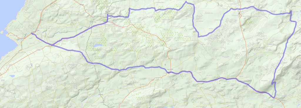
We took R479 out of Doolin, which in 5.5 km ends at N67.
Pretty much directly across is a local road, which goes for 6.5 km before merging left into R481 / Main St in Kilfenora, which almost immediately changes into R476. In 9 km, we turned left, onto the 3rd road after R480. (Our original intention had been to take the next turn, but the online directions to the Burren National Park visitor center were atrocious, and by the time we figured it out we decided it would be more fun to just continue on.) In 7.5 km the road ends, and we turned right onto L1014, then made the first left, by Clare's Rock Hostel. In 4.5 km, right after crossing R480, we intended to bear right at the Y, but some of us entrusted the map to others of us for whom directions are not a great strength. So we went left, which was beautiful in much the way the other branch would have been, but with more uphill. In 4.5 km more, we passed a really pretty little church and turned right. 3.5 km of that brought us back to the originally planned route. We stayed left at the Y, then turned a hard left at the T. After 1 km we turned right at the four-way crossroad. After 2 km that road turns a 90 degree angle, after which you can turn left at a 3-way intersection. 2 km later that road ends, and we turned left again and went ¾ km before turning right--if you cross the river, you missed that turn. Then you ride for 1.7 km in view of the river, which is nice, before hitting "downtown" Lisdoonvarna.
Co Clare, Ireland
-- 7/16/2014
