|
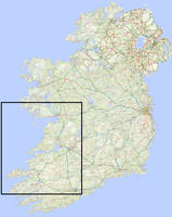
We went to Ireland. The southwest part of the country, specifically.
Ireland
-- 7/7/2014
|
|
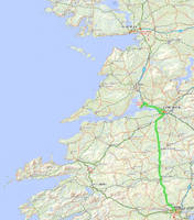
We flew into Shannon on Monday morning, and took the bus to Cork.
Bus Eireann turned out to be one of our best friends on the trip. They're clean and reasonably priced, they go almost everywhere, and they let you put your bike in the luggage compartments. The trip from Shannon to Cork took about 3 hours.
Co Clare, Ireland
-- 7/7/2014
|
|
Lots of places in Ireland have local bike rentals,
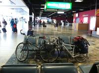
but they're all set up for day trips, and we couldn't find a reasonable way to rent bikes for the whole trip. So we packed ours in boxes and took them on the plane with us. Despite reading about it, we had a very inflated idea of how big the boxes are and how easy it is to fit your bike inside. It took us 2 hours to get them packed up before heading to the airport, and when we got in it took us about an hour to put them back together. We stored the boxes (one stuffed inside the other), along with the tools and bags that we didn't need for the trip (e.g. the pedal wrench), at the airport. It was supposed to cost 20 euro a week, but when we came back after two weeks the staff at the kept luggage desk said that sounded excessive to him, and he charged us 25 instead of 40. Here are our reconstituted bicycles, loaded up and ready to leave the airport in Shannon.
Co Clare, Ireland
-- 7/7/2014
|
|
In Cork, we settled in at our hostel and went to explore the English Market,
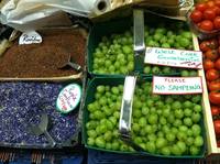
which claims to be the oldest continuously running indoor market--unclear what the scope of that claim is. Maybe the whole world. Our highlight there was the local cheese. It turns out Ireland has a budding local foods movement, and Cork is the culinary capital. We went to a fancy vegetarian restaurant the next night, which had good plant matter, but Ireland is mostly pasture, so the real deal is the meats and cheeses. Anyway, different vendors at the English Market had a lot of beautiful displays of produce and spices and animal products and things. Here are some.
Co Cork, Ireland
-- 7/7/2014
|
|
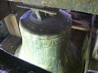
On Tuesday we toured St Anne's cathedral, which has a bell tower.
Co Cork, Ireland
-- 7/8/2014
|
|
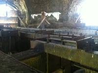
The bell tower had some pigeons.
Co Cork, Ireland
-- 7/8/2014
|
|
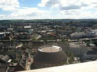
And really nice views from the top.
Co Cork, Ireland
-- 7/8/2014
|
|
Next we went to the Cork City Gaol,
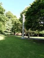
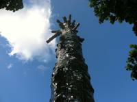
a former jail that then became a radio station, and now is a museum with a self-guided tour based around wax statues of different people and incidents from the jail's history. On the way there, we went through a city park that had a mirror tree.
Co Cork, Ireland
-- 7/8/2014
|
|
It was cool looking.
Co Cork, Ireland
-- 7/8/2014
|
|
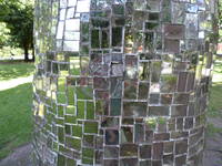
And reflective.
Co Cork, Ireland
-- 7/8/2014
|
|
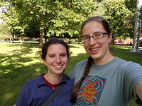
So we took a picture of ourselves.
Co Cork, Ireland
-- 7/8/2014
|
|
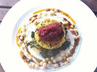
Marissa liked the visual presentation of the aforementioned fancy dinner at the vegetarian restaurant.
Co Cork, Ireland
-- 7/8/2014
|
|
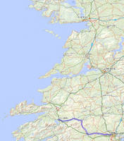
On Wednesday we went from Cork to Killarney.
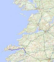
Our first day of biking was also our longest, perhaps leading one to question the soundness of our planning prowess. In any case: The most direct route from Cork to Killarney is along N22, which goes through the mountains, and we were advised that it has a wide shoulder and is much better graded than the smaller roads that run parallel for much of the way. We opted instead to do a longer route that we hoped would be quieter and prettier riding. It was, mostly, though what we ended up doing was wildly uneven in quality, and for us it was too much riding to be enjoyable for one day (or at least for the first day of riding). This was one of the few days on the trip where we were really biking to get to point B, and not particularly because we thought it would be a nice route. Annie liked big chunks of it enough to want to retool and make it work; Marissa thinks it would have been better either to bike to Macroom and take the bus the rest of the way, bus to Macroom and bike the rest of the way, or split it up over two days and stay at a bed and breakfast in Macroom in between.
Co Cork, Ireland
-- 7/9/2014
|
|
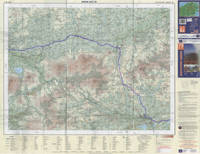
We took Pope's Quay (R846) west through the city,
and when we got to the university campus, we went off the road onto the rec trail to stay directly along the river. There's a bridge towards the end of the trail, which goes across to Mardyke Walk. At the end of Mardyke Walk, we took a right back over the river to Sunday's Well Rd / Lee Rd (total 3.5 km).
Left on Lee Rd for 5 km, at which point it ends and you merge right onto R618. The river bops in and out of view for this whole part of the ride. In 29.7 km, R618 merges with N22, which we took into Macroom but it was miserably fast, narrow, windy, and busy--it would have been better to stay right on Coolyhane Rd for 2 km until it ends. At that point you could turn left into Macroom, where we stopped for lunch at a nice park with a castle ruin which we did not tour. To continue, though, it's right onto Massytown Ter, and stay right / go straight until the fourth intersection, which is more of a Y than the previous ones. 10.6 km of beautiful, unpaved, poorly graded road later, merge right onto R582. We stayed on R582 for the rest of the way to Millstreet, but it was unpleasant due to high truck traffic--the recommended route would be to go 1 km until the right onto Drishane Rd, which goes for 8 km, and then either take the couple of turns on those back roads, or just merge back onto R582 for 1.3 km. R582 goes for another 11.3 km, then merges with N72 in Rathmore. On our map, N72 looked smaller and more manageable than N22, but we were too nervous about the zippy traffic and lack of shoulder to enjoy those 20 km. If distance were no object, it may have been nice instead of N72 to turn right on Clounts Court Rd, take the third left (soon before the creek crossing), right when that ends, and left at the Y onto the road that becomes Upper Park Rd when it meets N72 and R876 outside of Killarney. In any case, from the roundabout to R876, it's another 4 km into town.
Co Cork, Ireland
-- 7/9/2014
|
|
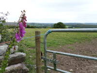
Climbing out of Macroom we got some nice views of the whole Lee River valley.
Co Cork, Ireland
-- 7/9/2014
|
|
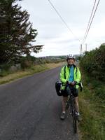
Marissa was cute.
Co Cork, Ireland
-- 7/9/2014
|
|
We stayed in Killarney overnight, walking around a little,
finding some groceries and a pair of pants, and heading out in the morning. It was a little reminiscent of Jackson Hole: touristy, with the image of itself as being outdoorsy, because it's on the edge of the Killarney National Park, which we were advised is meh. We had originally planned on staying another day in Killarney then going to Tralee for the weekend, but when we went to buy maps in Cork, the friendly bookstore manager recommended that we go to Dingle instead. So on Thursday we continued out to Dingle, which was a beautiful, enjoyable ride.
Co Kerry, Ireland
-- 7/10/2014
|

|
We picked great roads for day 4.
We headed north out of Killarney on High St, which becomes Rock Rd / N71, but even though it's a national road it's still a city street at that point and fine for biking. At the traffic circle (1.3 km) take N22 north for ¾ km, then left on L2019. 11.7 km later, jog right on R561 then the first left onto an unnamed (but well paved) road. After 3.8 km turn left (it's the first real left turn, not counting a couple really small roads), and stay on that road for 6 km. In Castlemaine, merge left onto N70 south, then immediately turn right on R561. R561 goes for 26 km, then as it's about to end at N86, turn left instead. That road is quite hilly but deserted and really beautiful. After 4 km it comes down to a rock beach with a castle ruin, and then makes a u turn to head up the next hill. 3.2 km later the roads again all lead to N86, except if you go left on a sort of gravelly mostly-paved road. In 2 km it joins N86 to go over a bridge, then you can go right immediately after the bridge, through a four-way crossroads, and left in 1 km. In about 7 km there's kind of a fork, and we accidentally went left, which took us out to N86 which we then had to take the rest of the way into Dingle, which was suboptimal. The original plan was to stay right at that fork onto Marian Park, which turns into John St after 1 km, which goes directly into downtown.
Co Kerry, Ireland
-- 7/10/2014
|
|
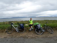
It didn't really rain, but it sprinkled on and off all day. Which was fine, and made us appreciate the sunshine. During one of the drier parts of the afternoon, we stopped for lunch in Inch.
Co Kerry, Ireland
-- 7/10/2014
|
|
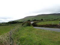
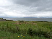
The gorgeous thing about this part of the ride, as we headed out the peninsula, was the everything-goes landscape. On one side of the road were mountains ...
Co Kerry, Ireland
-- 7/10/2014
|
|
... and ocean on the other.
Co Kerry, Ireland
-- 7/10/2014
|
|
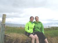
We were happy after eating.
Co Kerry, Ireland
-- 7/10/2014
|
|
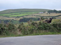
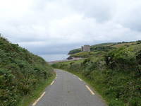
Partway out the peninsula R561 merges with N86, which we were not interested in biking on, so we took a mountainous detour which took us down past Minard Castle. The narrow, mostly-paved road was strenuous but pretty and had good views. Not many people, but lots of cows.
Co Kerry, Ireland
-- 7/10/2014
|
|
The castle came into view very dramatically on a long, steep, windy downhill.
Co Kerry, Ireland
-- 7/10/2014
|
|
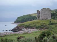
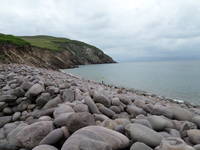
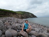
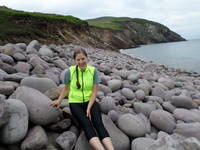
It's on a rock beach, somewhat reminiscent of the shore of Lake Ontario in Oswego.
Co Kerry, Ireland
-- 7/10/2014
|
|
Annie takes the downhills faster; by the time Marissa got there, there had been a removal of shoes and dipping of toes.
Co Kerry, Ireland
-- 7/10/2014
|
|
Marissa was too squeamish to interact directly with the water, but the beach still made her happy.
Co Kerry, Ireland
-- 7/10/2014
|
|
Annie was happy too.
Co Kerry, Ireland
-- 7/10/2014
|
|
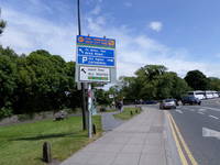
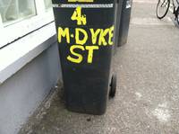
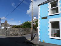
A thing to know about Ireland is that there are a lot of dykes. For example, here we have Dyke Road in Galway.
Co Galway, Ireland
-- 7/18/2014
|
|
And back in Cork, we had Mardyke Street.
Co Cork, Ireland
-- 7/8/2014
|
|
And in Dingle, our hostel was on Dykegate Street.
Co Kerry, Ireland
-- 7/10/2014
|

|
This is the point in the trip when Marissa discovered the camera's panorama mode.
We got into Dingle in the evening on Thursday, ate some mediocre yet expensive bar food, and found some fun live music to listen to. Every pub advertises "traditional Irish music at 9:30," but we found that usually means an Irish guitarist singing Bob Dylan covers. (The next weekend in Galway we walked by no less than 3 bars in which the live music featured "Wagon Wheel.") We found a three person group though who did a mix of American pop and traditional Irish tunes, and were excellent. Their tune sets were really tight with good rhythm, and they did a funny mash-up of Psycho Killer and Blister in the Sun. On Friday we went to the tourist information office, where the lady told us to visit the old lighthouse, which is a ~2 km walk along the water through the backs of people's pastures to an old square stone tower. It involved nice views of the bay. She also told us about opportunities to see trad music concerts--there was a world-class uilleann pipe player giving an afternoon and an evening concert, and there was another early evening concert at this place called the An Lab on the edge of town. We decided to find the An Lab, which turned out to be a small cultural center in a converted church at the back of an industrial park. We showed up and were clearly the only foreigners. The cultural center's mission included revival of the Irish language, so about three different lengthy introductions were conducted in Irish--we nodded and laughed. When the musicians started though the fiddler was very uncomfortable speaking in Irish so he switched to English and we got to understand the rest of the show. It was a CD release party, so they played through their album in order, including tracks with the fiddler's fiancé step dancing for rhythm, and the fiancé's mother singing. Then we went back to the hostel and had Shabbat dinner. Because sundown was at frickin 10 P.M. Who knew Ireland is basically at the North Pole?
Co Kerry, Ireland
-- 7/11/2014
|
|
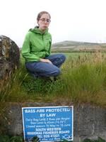
On the way to the lighthouse, we found a pertinent sign.
Co Kerry, Ireland
-- 7/11/2014
|
|
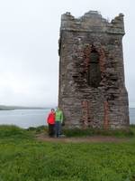
We met some nice people who took a picture of us at the lighthouse.
Co Kerry, Ireland
-- 7/11/2014
|
|
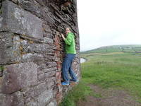
Then Annie climbed up the lighthouse. Only a little bit, and in an exceedingly safe manner.
Co Kerry, Ireland
-- 7/11/2014
|
|
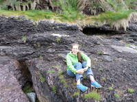
Then we went back down to the water, where Marissa spent a very long time looking for aquatic life in the tide pools, and Annie tried to look happy.
Co Kerry, Ireland
-- 7/11/2014
|
|
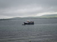
During our walk back to town, Fungie the Dolphin made an appearance.
The poor dolphin lives in Dingle Bay, and there are multiple tourist businesses based entirely on bringing people out on boats to try to see him. And his name is Fungie. Despite those humiliations, he seems interested in playing with the people. There was a big boat and a little boat while we were watching, and he kept almost capsizing the little boat while the big boat made sort of lumbering turns trying to keep him in view.
Co Kerry, Ireland
-- 7/11/2014
|
|
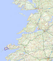
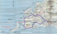
On Saturday we rode the loop around the end of the peninsula.
We found that about every third property owner in these coastal areas has capitalized on the archeology in their backyard and created a "museum"--the formula seems to be 1. erect a fence around the stone ruin, 2. charge 2 or 3 euro per person, 3. create a poster or two about the historical significance, don't copy-edit it, laminate it poorly, and put it on the wall. The Slea Head Loop is also where we started seeing signs for the "Wild Atlantic Way," which is a nationally designated route tracing the whole west coast of the country, and is very well signed, and which we basically followed for the rest of the trip until we got to Galway.
Co Kerry, Ireland
-- 7/12/2014
|
|
The Slea Head loop is primarily just biking on R559 out of town until it takes you back around the end of the peninsula to where you started.
We did the loop clockwise, with the southern shore first. Instead of taking the regional road out of town though, where it's kind of busy, we took Main St, which becomes Goat St, which becomes Ashmount Ter, all of which takes 1.5 km, then you're back on R559. Stay left when the two branches split. At one point you can take a left to stay closer along the coast on a local road, which then joins back up. If you're passing de Mordha B&B on R559, you've missed that turn and should just keep going. About ¾ of the way around the loop, R559 turns away from the water for the last time before going straight south back to town; at that point, you could stay left instead, first on Cois Farraige and then right at the first real road, left when that road ends, and left again at the end--which would expand the route and the coast time, eventually meeting up with R459, which also goes straight back into Dingle. The route we took is 43 km. The addition with R459 would add 7 km extra.
Dingle Peninsula, Co Kerry, Ireland
-- 7/12/2014
|
|
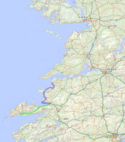
On Sunday we were scheduled to continue up the coast, headed eventually for Doolin and the Cliffs of Moher.
We took the bus to Tralee, where we'd originally planned to start out from, and followed the Wild Atlantic Way along the coast to Ballybunion. Which we just happened to pick off the map because of it was the town with a hostel that was in approximately the right place on our route for an overnight break. It happened to be a fun and interesting stop. We were the only foreigners there, though there weren't many locals either, it was mostly Irish people on vacation. This had been somewhat true in Dingle too, but there were a ton of foreign tourists there as well as the domestic vacationers. Marissa thought that if Dingle was like Cape Cod, then Ballybunion was like the Jersey shore. It's a family-oriented sort of has-been destination, with an arcade and a casino and ice cream shops, and--don't forget it's Irish--a 16th century castle ruin.
Co Kerry, Ireland
-- 7/13/2014
|
|
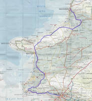
From the Tralee bus station, we took R874 around its loop of downtown until the right on Strand St (1.5 km).
In 0.5 km turn right again onto Spa Rd, which after 4 km spits you out onto R558. Go left on R558 for 6.6 km, then right onto Talaught Ln for 3 km. Turn left when the road T's in Glebe. In 1.5 km that road ends; go right for 0.5 km to the next T and then right again. After 2 km that road ends as well, take the left for 0.6 km, left again when that road ends in 0.8 km, and left after 3.5 km at the next T. In 1.9 km the road bends 90 degrees to the right, then in ¾ km it ends back at R551. Go left. After 6 km, in Dirtane, R551 takes a right turn, but you can go straight instead, then after 1 km right onto North Rd, which becomes Coast Rd, and 14.5 km later take a left back onto R551. And 9 km later you're in Ballybunion!
Co Kerry, Ireland
-- 7/13/2014
|
|
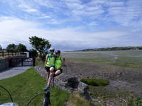
Marissa had us stop for a camera break near Churchhill.
Co Kerry, Ireland
-- 7/13/2014
|
|
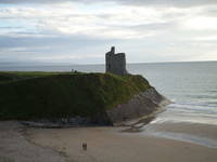
The beach in Ballybunion was the most beautiful one we saw.
It was a gorgeous day, too--Annie got sunburned, who would have thought, but only on the left side because we were riding north all day. But we got into town after 7, and by the time we had dinner it was getting chilly and we didn't swim. We thought of maybe delaying our start the next day to swim in the morning, but the next morning was horrible and rainy, so the weather decided that one for us.
Co Kerry, Ireland
-- 7/13/2014
|
|
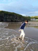
Marissa did venture to dip her toes in the water, but true to form, hopped like a sandpiper each time a wave came in, as though she couldn't have expected that to happen.
Co Kerry, Ireland
-- 7/13/2014
|
|
Monday was a tri-modal transport day.
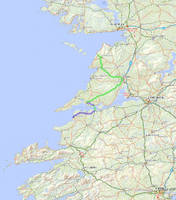
We biked from Ballybunion along the coast up to Tarbert, where we boarded the car ferry across the River Shannon, and then continued on to Kilrush. Rather than pull another Cork-to-Killarney-esque day, we decided to take the bus instead of figuring out how to avoid highways for the last 50+ km. So after 3 very soggy hours in the Kilrush "tourist information office" (a pub with a rack of flyers), we caught our friend the Bus Eireann up to Doolin.
Co Kerry, Ireland
-- 7/14/2014
|

|
We have no way of knowing how nice this part of the ride could be, because this was our one day of miserable cold rain, and we were mad grumpy.
However, I think it would be nice to do again. Take R551 north out of town, following a couple of turns. In 20 km, go left on L1010, which takes you around for 8.4 km before joining back up with R551 where it becomes N67. Go left on N67. In 2.5 km you will be at the ferry with nowhere else to go!
Co Kerry, Ireland
-- 7/14/2014
|
|
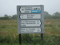
The wavy blue symbol is the sign for the Wild Atlantic Way. The reason for the picture, though, is the symbol for the car ferry--all morning we thought of the boa constrictor eating the elephant.
Co Kerry, Ireland
-- 7/14/2014
|
|
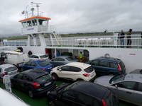
The car ferry was cool, if also cold.
Co Clare, Ireland
-- 7/14/2014
|
|
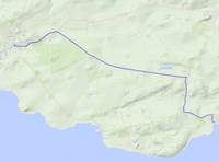
From the ferry, we went out to the main road and turned left on N67.
The first real right, after 1 km, leads up to a four-way crossroad in 1.3 km. Turn left, and in 5 km go left on R473, which takes you into Kilrush. This worked out great, featuring wild raspberries and even a little sunlight. If we had looked at the map more thoroughly before starting out, instead of taking N67 we would have gone right out of the ferry onto R486 and taken the first left--the first left off of that is back on our route.
Co Clare, Ireland
-- 7/14/2014
|
|
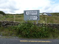
Dum ba-dum ba-dum ba-dum, ba-ba-ba-ba-ba-dum ba-ba-ba-ba-ba-dum, bum ba-dum ba-dum ba-dum, ba-dee-ba-dum ba-dum bum ba-dum ... ok, so my singing voice doesn't translate very well. The point is, we were excited about the Road to Lisdoonvarna.
Co Clare, Ireland
-- 7/14/2014
|
|
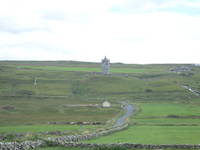
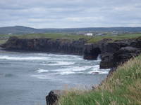
Really, though, what most excited Marissa about the whole trip was the ubiquity of castle ruins. Here, for example, is one we saw outside of Doolin.
Co Clare, Ireland
-- 7/15/2014
|
|
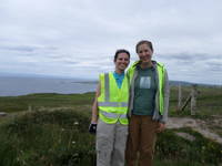
One of the hostelers in Dingle recommended a dirt road along the cliffs for 2 km leading up to the Cliffs of Moher, and said she thought we could probably bike it.
We could not. So we walked and carried our bikes along the narrow trail, up and down stone steps, across streams, etc. It was worth it, due to the extreme beauty and lack of crowds. It was cool to see what the cliffs in the whole area looked like, to see what was different about the official Cliffs of Moher.
Co Clare, Ireland
-- 7/15/2014
|
|
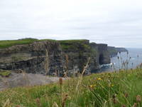
At about this point on the trail, almost at the end, we were passed by a tour group.
The guide stopped and harangued us about how you're not allowed to bike on the trail. We nodded and smiled. Turns out he was one of the farmers whose land the trail goes through, and he had organized the other farmers to create the trail a couple years ago. He threatened to make us walk all the way back (which didn't actually make any sense if the goal is to minimize bike traffic on the trail), but when we didn't get mad at him he said we could just finish up in our intended direction of travel.
Co Clare, Ireland
-- 7/15/2014
|
|
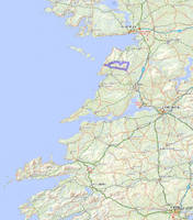
The cliffs.
Co Clare, Ireland
-- 7/15/2014
|

|
And the steps for viewing them. There's also a row of shops, and a shmancy visitor center, all of which feels very much like Niagara Falls.
Though we encountered a lot of those homemade "museums" trying to sell their backyards to tourists, the cliffs of Moher managed to commodify nature in a sleeker way that we didn't otherwise see on the trip.
Co Clare, Ireland
-- 7/15/2014
|
|
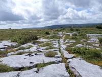
On Wednesday we went to see the Burren, the area around Doolin that has an awesome moonscape kind of geology.
We tried to find some kind of infrastructure related to where to enter the park, or what routes were good for hiking, but it turns out that's not actually how Irish national parks work. The website gave directions, conspicuously lacking in street names, to an area with trails, which we found when we got there were dirt roads on private land, so we decided to continue touring by bike instead. Which turned out to be a pretty good idea, and made for a nice day.
Co Clare, Ireland
-- 7/16/2014
|

|
We took R479 out of Doolin, which in 5.5 km ends at N67.
Pretty much directly across is a local road, which goes for 6.5 km before merging left into R481 / Main St in Kilfenora, which almost immediately changes into R476. In 9 km, we turned left, onto the 3rd road after R480. (Our original intention had been to take the next turn, but the online directions to the Burren National Park visitor center were atrocious, and by the time we figured it out we decided it would be more fun to just continue on.) In 7.5 km the road ends, and we turned right onto L1014, then made the first left, by Clare's Rock Hostel. In 4.5 km, right after crossing R480, we intended to bear right at the Y, but some of us entrusted the map to others of us for whom directions are not a great strength. So we went left, which was beautiful in much the way the other branch would have been, but with more uphill. In 4.5 km more, we passed a really pretty little church and turned right. 3.5 km of that brought us back to the originally planned route. We stayed left at the Y, then turned a hard left at the T. After 1 km we turned right at the four-way crossroad. After 2 km that road turns a 90 degree angle, after which you can turn left at a 3-way intersection. 2 km later that road ends, and we turned left again and went ¾ km before turning right--if you cross the river, you missed that turn. Then you ride for 1.7 km in view of the river, which is nice, before hitting "downtown" Lisdoonvarna.
Co Clare, Ireland
-- 7/16/2014
|
|
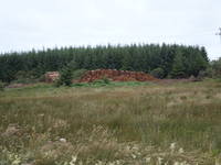
On the way to the Burren we saw a logging enterprise, which Marissa photographed extensively.
Co Clare, Ireland
-- 7/16/2014
|
|
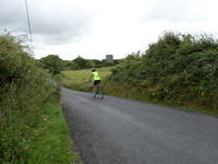
We passed more castles.
Co Clare, Ireland
-- 7/16/2014
|
|
When we got to the top of our hill, this is what it looked like. Pretty crazy, right?
Co Clare, Ireland
-- 7/16/2014
|
|
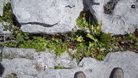
The cracks between the rocks have lots of stuff growing in them.
Co Clare, Ireland
-- 7/16/2014
|

|
Marissa thought this was really interesting.
Co Clare, Ireland
-- 7/16/2014
|
|
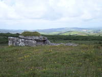
On the other side of the road was a slab tomb. It's possible that's not the correct name for them.
Co Clare, Ireland
-- 7/16/2014
|
|
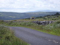
We stopped for lunch, and while we were picnicking we noticed a woman in a green shirt meditating by the tomb. It turned out she was a French tourist staying at the same hostel as us. She was amazed that we'd biked the 25 km to get there, and we were amazed that she'd hitchhiked.
Co Clare, Ireland
-- 7/16/2014
|
|
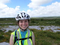
Marissa was cute.
Co Clare, Ireland
-- 7/16/2014
|
|
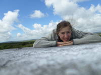
Annie took a nap.
Co Clare, Ireland
-- 7/16/2014
|
|
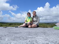
Then we both posed for the camera.
Co Clare, Ireland
-- 7/16/2014
|
|
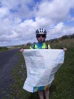
Marissa hydrated while helping with the challenging task of refolding the map in the wind.
Co Clare, Ireland
-- 7/16/2014
|
|
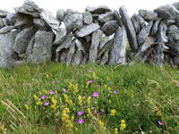
There are a ton of stone walls everywhere, delineating pastures, from the size of American fields down to the size of a city lot. On our Burren ride though we saw a bigger diversity of stone walls than elsewhere. This is more like the usual type of construction.
Co Clare, Ireland
-- 7/16/2014
|
|
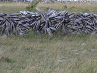
This is a more atypical construction.
Co Clare, Ireland
-- 7/16/2014
|

|
They were everywhere.
Co Clare, Ireland
-- 7/16/2014
|

|
Also wind turbines.
Co Clare, Ireland
-- 7/16/2014
|
|
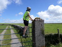
Marissa needed a little assistance to appreciate some of the views.
Co Clare, Ireland
-- 7/16/2014
|
|
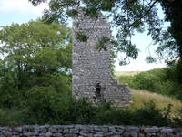
She did not, however, need any assistance to appreciate the castles.
Co Clare, Ireland
-- 7/16/2014
|
|
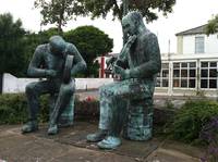
In the central square of Lisdoonvarna, there are some musicians.
They both have instruments, except the fiddler is having some trouble playing his, due to the sad stub of a bow in his right hand. The problem is just that his bodhran away. We hung around in Lisdoonvarna, got groceries and ice cream, ate our picnic dinner, got some tea so we could sit in a nice restaurant for an hour, and wrote post cards. Then we went to the Smokehouse, a pub that we heard would have a good session, and we tried the local microbrewery's stout, which was good. And the session was fine. But we found the session in Doolin was actually better, one of our two favorites during the trip. And they had Murphy's Irish stout, which revolutionized the Rose-Weiss household's relationship to beer.
Co Clare, Ireland
-- 7/16/2014
|
|
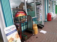
Marissa was excited to see peat for sale.
Co Clare, Ireland
-- 7/16/2014
|
|
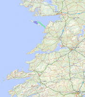
On Thursday morning we took the ferry to Inishmor, the largest of the Aran Islands.
Co Clare, Ireland
-- 7/17/2014
|
|
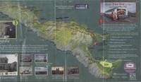
We stayed at the Kilronan Hostel, biked to the Black Fort (#7), and then out the high road to Dun Aengus (#3) and back along the low road.
Co Clare, Ireland
-- 7/17/2014
|
|
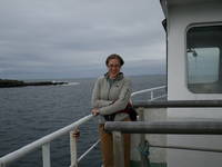
The ferry made Annie a little ill, but she smiled for the camera.
Co Clare, Ireland
-- 7/17/2014
|
|
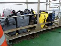
There were several other bikers on the ferry. We were like an Ortlieb promotion. It was a little embarrassing, because most of the other bikers were were snooty and obnoxious (and American), but overall we were still happy about our gear.
Co Clare, Ireland
-- 7/17/2014
|
|
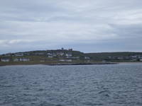
The closest Island to the mainland is Inisheer. About which there is a waltz. Annie spent the rest of the day playing it on her tin whistle, much to the chagrin of everyone in earshot. Which was mostly cows, and Marissa.
Co Clare, Ireland
-- 7/17/2014
|
|
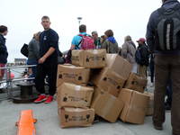
On the pier at Inishmor, there were some people who learned about making deliveries from the folks at SKS Packaging. (As Jeff can tell you.)
Co Clare, Ireland
-- 7/17/2014
|
|
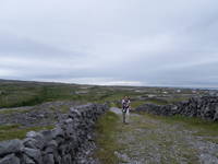
We biked partway to the Black Fort but had to switch to walking when the path got too gravelly. Here, Marissa is walking up the path.
Co Clare, Ireland
-- 7/17/2014
|

|
The Black Fort is one of three Bronze Age fortresses on Inishmor, which are basically 4 concentric circular walls made out of a whole lot of small stones.
They're all built in impressive locations, due to strategery, but also beneficial in their modern role as tourist attractions. This one is on some sea cliffs. The wavy line way at the end in the middle of the photo is the fort. The Black Fort in particular is in poor repair, so it isn't nearly as interesting to look at as the other two we saw. We'll get to those soon.
Co Clare, Ireland
-- 7/17/2014
|
|
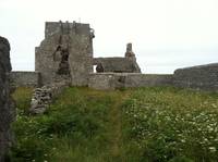
The second fort, Dun Eochla, is accessible from the road via a more recent stone ruin, we think of a church, but it had a funny concession stand type structure outside of it. Marissa really liked it and took a lot of pictures.
Co Clare, Ireland
-- 7/17/2014
|
|
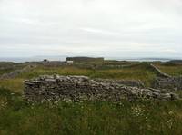
The funny thing about archeological sites in Ireland is that sometimes you see more animals investigating them than people. The innermost wall of this fort is fairly intact, and the second is visibly remnant, but the third wall has been converted into one of those stone walls that delineate property, and the rest of the area in the fort is divided into pastures.
Co Clare, Ireland
-- 7/17/2014
|

|
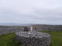
This is the first wall, viewed from the inside of the fort. The panorama mode on the camera isn't great on the distortion front, so it makes the wall look not nearly as circular as it is in reality.
Co Clare, Ireland
-- 7/17/2014
|
|
The podium in the center of the fort is quite large compared to a Marissa.
Co Clare, Ireland
-- 7/17/2014
|
|
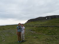
The pastureland approach to the preservation of historic sites did not extend to the third of the forts, which has a "museum" (a la Dingle Peninsula) and an admission fee to walk to the fort.
Which has a couple of signs on it that say "Please do not climb on our national heritage." The museum did have some cool information, even though the featured pictures of a circle fort was from an Arctic Scottish island rather than one of the local specimens. There we learned that our difficulty in approaching the fort was intentional on the part of the builders--between the second and third walls, they planted big stones at a 45 degree angle so it's impossible to walk straight up.
Co Clare, Ireland
-- 7/17/2014
|
|
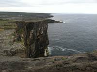
Dun Aengus is directly on the sea cliffs, but instead of a protective fence for the people, the only fence we saw was perpendicular to the cliffs, keeping the grazing animals out.
Co Clare, Ireland
-- 7/17/2014
|
|
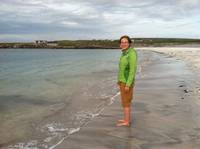
On the way back we stopped at a really beautiful beach. If we hadn't been so hungry we probably would have swum despite leaving our bathing suits at the hostel.
Co Clare, Ireland
-- 7/17/2014
|
|
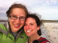
But we were mad hungry, so instead we took a selfie.
Co Clare, Ireland
-- 7/17/2014
|
|
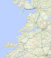
On Friday we took the ferry off the island in the other direction, to Rossaveal in County Galway. Then we biked into Galway City.
Co Galway, Ireland
-- 7/18/2014
|

|
Left onto R372, then right in 0.5 km. In 2.7 km that road ends; turn left, and in 2.5 km merge right onto R336. In 27.5 km, you'll be in the outskirts of Galway. We turned up R337, to R338, to R339, because we were staying out in Mervue. To get downtown, stay on R336 for another 4.5 km.
Co Galway, Ireland
-- 7/18/2014
|

|
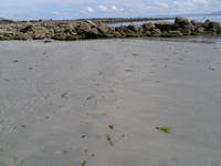
About halfway to Galway, we stopped at the beach in Spiddal. It was around 70 degrees and basically sunny, which translated into Irish means "get thee to the beach!" We were excited to join the fray.
Co Galway, Ireland
-- 7/18/2014
|
|
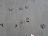
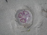
When we got closer to the water though, there were all these translucent purple jellyfish in the sand.
Co Galway, Ireland
-- 7/18/2014
|
|
They were everywhere.
Co Galway, Ireland
-- 7/18/2014
|
|
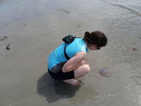
They were quite pretty.
Co Galway, Ireland
-- 7/18/2014
|
|
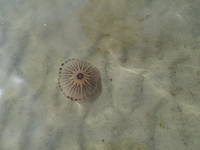
Marissa investigated, like a scientist.
Then we stood around for about fifteen minutes with our toes in the water, vigilant for the jellyfish that were EVERYWHERE. We really wanted to swim, and weighed the idea that it would be worth it even if we got stung, and decided it wasn't worth it, but couldn't quite leave. Then we saw a toddler in a pink bikini barrel down the beach holding a jellyfish and screaming "Look Daddy, I got one!" We were both checking ourselves from shouting for her to drop it. But then her father followed her into the water, scooped up a jellyfish, and tossed it at her. We asked him if they stung, and he said no, and dropped one into our hands. Then we swam! It turns out that brushing up against floating gelatinous blobs every few seconds is a totally painless but very odd feeling.
Co Galway, Ireland
-- 7/18/2014
|
|
The purple jellyfish are harmless, but the dark ones do sting. (Spoiler alert: neither of us got stung.)
Co Galway, Ireland
-- 7/18/2014
|
|
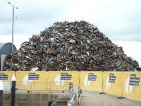
Our time in Galway coincided with the Galway International Arts Festival, which we experienced mostly on Shabbat so we don't have pictures. But we went to this one warehouse outfitted as a sculpture gallery, and when we walked out we saw this enormous pile of metal, which we had to examine for a few minutes before discerning that it was in fact a scrap metal heap and not another large-format installation. It looked like art though.
Co Galway, Ireland
-- 7/18/2014
|
|
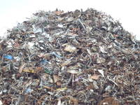
Then up close you could see it looked a little more like plain garbage.
We also attended a neat community group's theater of the oppressed skit about hydrofracking, which is apparently coming to Ireland. And, on Saturday night, we saw a performance involving a 30-foot-tall metal dragon which paraded through downtown Galway with musicians playing techno rock opera on its back. When it arrived at the Spanish Arch, several acrobats on those bouncy stilts did things on their stilts involving sword-fighting, somersaults, jumping rope, and hanging from various parts of the dragon. Then each of the scales along the dragon's neck and back shot off fireworks.
Co Galway, Ireland
-- 7/18/2014
|
|
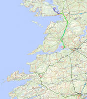
On Sunday we packed out of our airbnb and biked northwest out of Galway through the Connemarra region. Then we came back into town and took the bus to Shannon, where we stayed overnight before getting on a plane the next morning.
Co Galway, Ireland
-- 7/20/2014
|
|
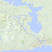
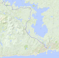
From Mervue, we took R338 to make a right on Upper Newcastle Rd (R864). In 1 km it merges with N59. After 9 km on N59, we went right on L1320 in Moycullen for 6 km, then turned left. From there, the first real left turn is in 3.3 km, which goes back toward N59, via Ross Lake. Then we took N59 for 12 km back into Galway, straight to R864, left on R863 into Eyre Square.
Co Galway, Ireland
-- 7/20/2014
|
|
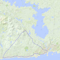
A few years ago Annie went to visit Bekah in Galway, and they took a beautiful bike ride through pastures and peat bogs and fishing villages.
We didn't do that route because the last third is a repeat of where we'd already biked, but overall it's a more fun ride than the route we took toward Lough Corrib. Anyway, this route. Starts out the same way--from downtown, take Bridge St until it ends, right on R864 for 1 km, continue onto Upper Newcastle Rd for 1 km, join up with N59. Stay on N59 for 9 km, then turn left in Moycullen onto L1320. It ends in 13.5 km at the Spiddal harbor; left onto R336 takes you back to Galway. Soon after the split with R864, you can stay right on Grattan Rd to go along the Claddagh.
Co Galway, Ireland
-- 7/20/2014
|
|
If we'd had all day, we might have tried to go out to Oughterard, and on the way back maybe wind through some of the back roads south of N59.
Co Galway, Ireland
-- 7/20/2014
|
|
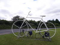
Outside of Moycullen we passed a bicycle place. Our bikes felt kinship to their larger ancestor.
Co Galway, Ireland
-- 7/20/2014
|
|
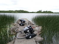
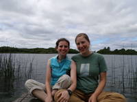
We stopped for lunch at Ross Lake. We dragged our bikes along a trail in the woods, and when it opened out along the edge of the lake there were these little piers every few yards, which created private spaces for all the different people there.
Co Galway, Ireland
-- 7/20/2014
|
|
That's us, and Ross Lake. Then we biked back to Galway and went to the bus station and took a bus to Shannon, and stayed in a motel and biked to the airport in the morning. Into a box, 12 hours, out of a box, and a couple of tube changes later, we biked ourselves home from Logan!
Co Galway, Ireland
-- 7/20/2014
|